We are a group of engaged, concerned citizens who care about Holliston’s water. Our water impacts ALL of us EVERY day. Regardless of where you live in town, our water sources are shared and mixed, making this a town wide issue.
The Issue:
We are deeply concerned about the proposal to build any structure, directly or indirectly producing pollutants, on top of our wellhead protection area, within a flood zone, and adjacent to sensitive wetlands and river front.
Background:
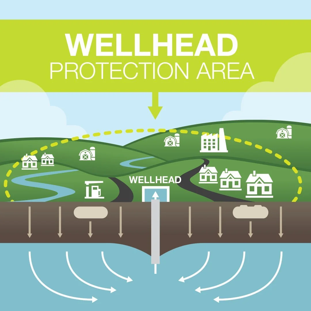
A wellhead protection area is defined as the surface and subsurface area surrounding a water well or wellfield, supplying a public water system, through which contaminants are reasonably likely to move toward and reach such water well or wellfield. They are designed to prevent contamination of the aquifers that supply drinking water. Our aquifer is the lifeline of this community - it provides the clean, safe drinking water that residents, schools, and businesses rely on every day.
Building in such a critical location poses unacceptable risks, including:
Contamination: Fuel, road salt, oil, chemical runoff, and other hazardous materials associated with DPW operations could leach into our groundwater supply.
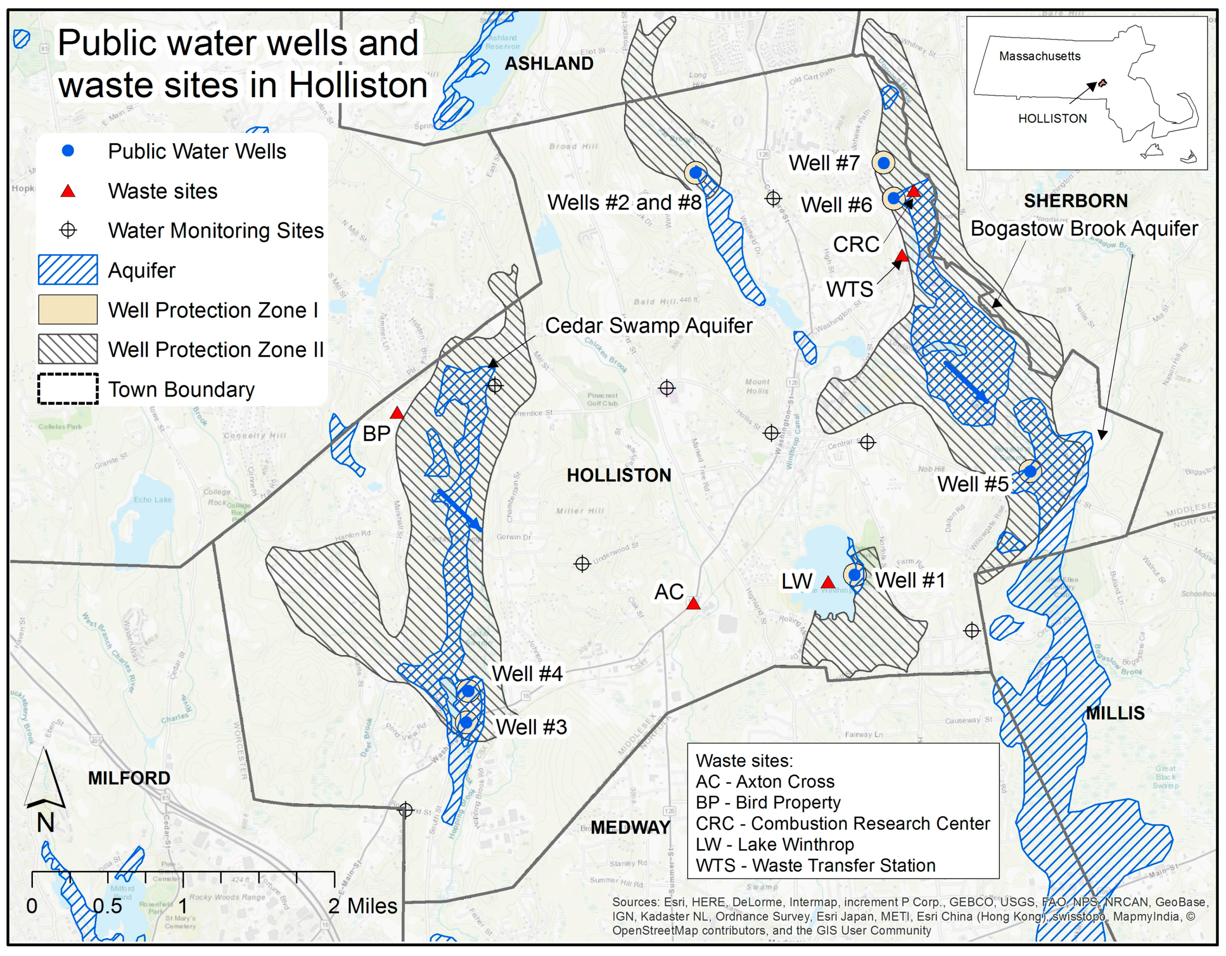
Holliston draws its drinking water from very shallow groundwater sources. Studies highlight that these “very shallow aquifers” are highly susceptible to contamination from industrial chemicals and naturally occurring metals. Our own Town’s Source Water Assessment Program (SWAP) reports from MassDEP assign a high susceptibility ranking to the aquifer located on Lowland street.
Flooding risk: Locating a facility in a flood zone increases the chance of spills and contamination during storm events, which are becoming more frequent and severe.
Flooding can overwhelm containment systems and carry hazardous materials (road salt, fuel, solvents, oils, pesticides) directly into groundwater and wetlands. Even minor leaks or spills from DPW operations may spread widely in floodwaters, bypassing normal stormwater treatment structures and seeping quickly into a shallow aquifer. Additionally, floodwaters can damage storage tanks, salt piles, and chemical containment areas, releasing pollutants during high-water events.
With increasing frequency and severity of storms in Massachusetts, floodplain siting exposes Holliston to escalating risks over time, not diminishing ones.
Holliston’s updated hazard mitigation plan (2024) anticipates changing precipitation patterns—shorter, more intense rainfall, hotter summers, and overall climate volatility - that may stress aquifers and elevate both flooding risks and contamination potential.
Wetland destruction: Wetlands naturally filter water, absorb floodwaters, and provide habitat for wildlife. Development in this area threatens these ecological protections and the balance of our local environment
Even With “Safeguards,” Risk Remains
While engineers may design containment systems and best practices to protect against spills, no system is fail-proof.
Human Error: Accidents such as improperly sealed valves, equipment malfunction, or simple oversight can lead to leaks and spills—even in well-engineered facilities.
Maintenance Gaps: Over time, storage tanks, pipes, and liners deteriorate. Deferred maintenance or missed inspections can quickly compromise protection systems.
Flooding Multiplier: Any error or system failure in a flood zone magnifies the spread of contamination, making cleanup nearly impossible.
History shows that many groundwater contamination events in New England towns began not from catastrophic system collapse, but from small, preventable mistakes that went undetected until residents’ water was unsafe to drink
This is not hypothetical - Safe Guards Fail!
In Woburn, industrial solvents polluted two municipal wells—despite buffer zones—demonstrating how quickly aquifer contamination can spread and become dangerous
In Acton, DPW operations—especially salt storage and vehicle washing—contributed to elevated salt levels in local waterways and wells. Acton & OARS water committees indicate that salt from road treatment practices has contributed to rising chloride levels in wells, affecting water quality and even posing health concerns
Numerous towns—including Becket, Braintree, Randolph, Springfield, and Charlton—saw salt and industrial practices drive contamination in groundwater, impacting wells and private supplies.
EPA estimates that over 400,000 UST gas/oil releases have been confirmed across the U.S., many affecting groundwater.
Holliston shares its northeastern boundary with Sherborn and Bogastow Brook aquifer. As Sherborn is almost entirely reliant on private wells, with virtually 99% of its water supply coming from local groundwater, this proposal may have direct impacts to Sherborn residents as well.
Once our aquifer is polluted, it cannot easily be restored. Safe, clean drinking water is a basic right, and we cannot put it in jeopardy. There are other proposed sites in Town that are not in wellhead protection zones.
